Geolocate

Fostertown topographic map

Click on the map to display elevation.

About this map
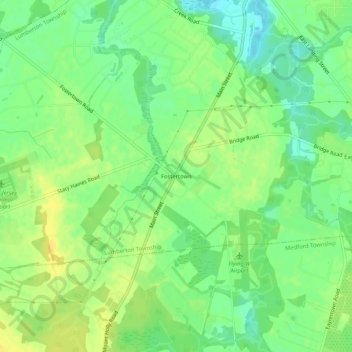
Name: Fostertown topographic map, elevation, terrain.

Location: Fostertown, Lumberton Township, Burlington County, New Jersey, 08036, United States (39.92289 -74.83739 39.96289 -74.79739)

Average elevation: 46 ft

Minimum elevation: 3 ft

Maximum elevation: 85 ft

Burlington County trails, hiking, mountain biking, running and outdoor activities

Gear up for your next adventure:

🏫Relief Map Kits - Hands-on tools for teaching landforms and elevation
🪶Survival Guide Book - Expert advice for emergency preparedness
🔌Solar Panel Charger - Charge gear sustainably outdoors
💧Water Purification System - Clean water on the trail with reliable purifiers
📖Nature Tracking Books - Learn to track wildlife and terrain

As an Amazon Associate, this site earns from qualifying purchases at no extra cost to you.