
Orocué topographic map
Interactive map
Click on the map to display elevation.
About this map
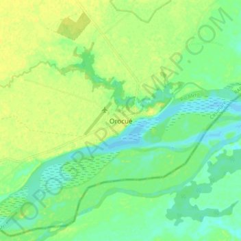
Name: Orocué topographic map, elevation, terrain.
Location: Orocué, Casanare, Colombia (4.74948 -71.38064 4.82948 -71.30064)
Average elevation: 427 ft
Minimum elevation: 397 ft
Maximum elevation: 453 ft
Other topographic maps
Click on a map to view its topography, its elevation and its terrain.
El Almorzadero
El Almorzadero, Orocué, Casanare, Colombia
Average elevation: 486 ft