Geolocate

Clapham topographic map

Click on the map to display elevation.

About this map
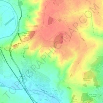
Name: Clapham topographic map, elevation, terrain.

Location: Clapham, Bedford, England, United Kingdom (52.15650 -0.51512 52.19239 -0.46670)

Average elevation: 197 ft

Minimum elevation: 98 ft

Maximum elevation: 295 ft

Gear up for your next adventure:

🎒Day Hiking Backpack - Lightweight backpack perfect for day trips and outdoor adventures
🚗GPS Dash Cams - Record your scenic drives through mountain passes and canyons
🪶Thermal Camp Blanket - Extra warmth for cold nights
🧦Hiking Socks - Comfortable socks to prevent blisters on long hikes
📖Nature Tracking Books - Learn to track wildlife and terrain

As an Amazon Associate, this site earns from qualifying purchases at no extra cost to you.