Geolocate

Niamtougou topographic map

Click on the map to display elevation.

About this map
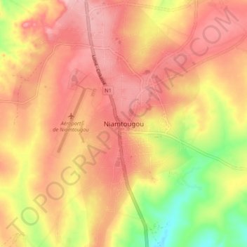
Name: Niamtougou topographic map, elevation, terrain.

Location: Niamtougou, Doufelgou, Kara Region, Togo (9.72628 1.06841 9.80628 1.14841)

Average elevation: 1,450 ft

Minimum elevation: 1,175 ft

Maximum elevation: 1,604 ft

Gear up for your next adventure:

🥾Women's Hiking Boots - Top-rated trail boots with ankle support and superior grip
📡Handheld GPS Device - Reliable handheld GPS for outdoor navigation
⌚GPS Sports Watch - GPS watch for running, hiking and training
🩹Survival Bandages - High‑quality bandages for emergencies
🪶LED Camping Lantern - Bright lantern for camp lighting

As an Amazon Associate, this site earns from qualifying purchases at no extra cost to you.