Geolocate

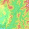
Verdivia Falls topographic map

Click on the map to display elevation.

About this map

Name: Verdivia Falls topographic map, elevation, terrain.

Location: Verdivia Falls, Doña Remedios Trinidad, Bulacan, Central Luzon, Philippines (15.09935 121.11328 15.09945 121.11338)

Average elevation: 666 ft

Minimum elevation: 374 ft

Maximum elevation: 1,102 ft

Other topographic maps

Click on a map to view its topography, its elevation and its terrain.
Gear up for your next adventure:

🌄Hiking Binoculars - Compact binoculars for scenic views and trail spotting
🗻Climbing Gear Basics - Essential gear for beginner climbers
🧭Map Reading Tools - Tools and kits for map navigation
🧭Pro Hiking Compasses - High-accuracy liquid-filled compasses for topographic orientation
📖Nature Tracking Books - Learn to track wildlife and terrain

As an Amazon Associate, this site earns from qualifying purchases at no extra cost to you.