Geolocate

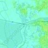
Dhaka Metropolitan topographic map

Click on the map to display elevation.

About this map

Name: Dhaka Metropolitan topographic map, elevation, terrain.

Location: Dhaka Metropolitan, Dhaka District, Dhaka Division, Bangladesh (23.66808 90.32978 23.90010 90.51293)

Average elevation: 23 ft

Minimum elevation: -10 ft

Maximum elevation: 72 ft

Other topographic maps

Click on a map to view its topography, its elevation and its terrain.

Dhanmondi Lake Park

Bangladesh > Dhaka Division > Dhaka

Average elevation: 49 ft

Turag River

Bangladesh > Dhaka Division

Average elevation: 16 ft

Ati

Bangladesh > Dhaka Division > Keraniganj Subdistrict

Average elevation: 16 ft

Birulia

Bangladesh > Dhaka Division > Savar Subdistrict

Average elevation: 20 ft

Khagan

Bangladesh > Dhaka Division > Savar Subdistrict

Average elevation: 39 ft

Rajason

Bangladesh > Dhaka Division > Savar Subdistrict

Average elevation: 33 ft

Pangsha

Bangladesh > Dhaka Division > Pangsha

Average elevation: 36 ft

Gear up for your next adventure:

🖼️Topo Map Wall Art - Decorative topographic prints of famous peaks and regions
🪵Folding Camp Saw - Compact saw for wood and campsite work
🪓Survival Multi‑Tool - Versatile tool for camp and trail tasks
☕Camping Coffee Makers - Enjoy premium coffee at the summit or campsite
🎒Trekking Poles - Sturdy poles for balance and stability on rough terrain

As an Amazon Associate, this site earns from qualifying purchases at no extra cost to you.