Geolocate

Husn topographic map

Click on the map to display elevation.

About this map
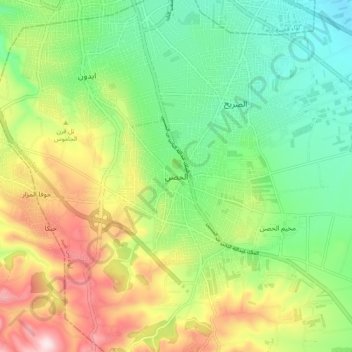
Name: Husn topographic map, elevation, terrain.

Location: Husn, Bani Obeid Sub-District, Bani Obeid District, Irbid, 21110, Jordan (32.44778 35.84000 32.52778 35.92000)

Average elevation: 2,238 ft

Minimum elevation: 1,690 ft

Maximum elevation: 3,136 ft

Other topographic maps

Click on a map to view its topography, its elevation and its terrain.

King Abdullah II Park

Jordan > Irbid > Bani Obeid Sub-District > Irbid

Average elevation: 1,893 ft

Gear up for your next adventure:

🌲Outdoor Survival Books - Best books on survival skills
🕶️GPS Smartphone Mount - Secure mount for phone navigation
🎒Trekking Poles - Sturdy poles for balance and stability on rough terrain
😴Insulated Sleeping Pads - Compact and warm pads for high-elevation camping
💧Water Filtration Bottles - Safely drink from streams and lakes while exploring

As an Amazon Associate, this site earns from qualifying purchases at no extra cost to you.