
Thank you for supporting this site ❤️
Make a donation
Make a donation
Gear up for your next adventure:
As an Amazon Associate, this site earns from qualifying purchases at no extra cost to you.
Kulob topographic map
Click on the map to display elevation.
Thank you for supporting this site ❤️
Make a donation
Make a donation
Gear up for your next adventure:
As an Amazon Associate, this site earns from qualifying purchases at no extra cost to you.
About this map
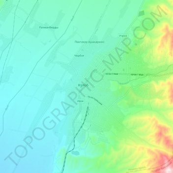
Name: Kulob topographic map, elevation, terrain.
Location: Kulob, Kulob District, Khatlon Region, 735140, Tajikistan (37.87544 69.73356 37.93863 69.84976)
Average elevation: 2,080 ft
Minimum elevation: 1,660 ft
Maximum elevation: 3,760 ft
Thank you for supporting this site ❤️
Make a donation
Make a donation
Gear up for your next adventure:
As an Amazon Associate, this site earns from qualifying purchases at no extra cost to you.