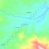
Tena topographic map
Click on the map to display elevation.
Tena
The road from Quito to Tena is 99% paved as of 2021. It includes a spectacular passage over Papallacta Pass, above 4,000 m elevation, as well as views of several waterfalls. On clear days the 3,990 m Sumaco volcano can be seen to the east. There is bus service to Tena via Baeza which takes about 4 hours, and private transport from Quito takes about 3 to 3.5 hours. Small yellow truck-taxis are abundant in the city and cost $1.25.
About this map

Name: Tena topographic map, elevation, terrain.
Location: Tena, Napo, Ecuador (-1.03470 -78.03846 -0.86816 -77.75335)
Average elevation: 2,769 ft
Minimum elevation: 1,270 ft
Maximum elevation: 8,930 ft
Other topographic maps
Click on a map to view its topography, its elevation and its terrain.