Geolocate

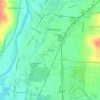
Fairfield topographic map

Click on the map to display elevation.

About this map

Name: Fairfield topographic map, elevation, terrain.

Location: Fairfield, Butler County, Ohio, 45014, United States (39.30147 -84.62992 39.36679 -84.47683)

Average elevation: 699 ft

Minimum elevation: 518 ft

Maximum elevation: 1,020 ft

Butler County trails, hiking, mountain biking, running and outdoor activities

Other topographic maps

Click on a map to view its topography, its elevation and its terrain.

Shandon

United States > Ohio > Butler County

Average elevation: 666 ft

South Highlands

United States > Ohio > Butler County > Middletown

Average elevation: 702 ft

Busenbark

United States > Ohio > Butler County

Average elevation: 663 ft

Hughes

United States > Ohio > Butler County

Average elevation: 778 ft

Maud

United States > Ohio > Butler County

Average elevation: 830 ft

Warwickshire

United States > Ohio > Butler County > Hamilton

Average elevation: 636 ft

Oakland

United States > Ohio > Butler County > Middletown

Average elevation: 663 ft

Williamsdale

United States > Ohio > Butler County

Average elevation: 633 ft

McGonigle

United States > Ohio > Butler County

Average elevation: 873 ft

Astoria

United States > Ohio > Butler County

Average elevation: 863 ft

Gear up for your next adventure:

🥤Water Filter Bottle - All‑in‑one filter bottle for safe hydration
🥩Freeze-Dried Meals - Nutritious and lightweight food for remote expeditions
⛺Backpacking Tents - Weight-optimized shelters for multi-day topographic surveys
🦶Carbon Trekking Poles - Reduce knee impact on steep descents with ultra-light poles
🪶Compact Camp Shovel - Folding shovel for campsite tasks

As an Amazon Associate, this site earns from qualifying purchases at no extra cost to you.