Geolocate

Cahecho topographic map

Click on the map to display elevation.

About this map
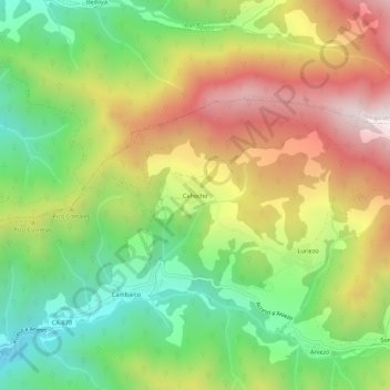
Name: Cahecho topographic map, elevation, terrain.

Location: Cahecho, Cabezón de Liébana, Cantabria, 39571, Spain (43.14029 -4.57362 43.18029 -4.53362)

Average elevation: 2,598 ft

Minimum elevation: 1,191 ft

Maximum elevation: 4,354 ft

Gear up for your next adventure:

⛺Backpacking Tents - Weight-optimized shelters for multi-day topographic surveys
📻Weather Alert Radios - Stay informed of storm risks while off-the-grid
🥩Freeze-Dried Meals - Nutritious and lightweight food for remote expeditions
🎒Gear Packing Cubes - Organize your backpack efficiently
🧦Merino Wool Socks - Moisture-wicking, blister-preventing socks for long treks

As an Amazon Associate, this site earns from qualifying purchases at no extra cost to you.