Geolocate

Lauterbach topographic map

Click on the map to display elevation.

About this map

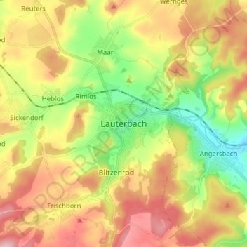
Name: Lauterbach topographic map, elevation, terrain.

Location: Lauterbach, Vogelsbergkreis, Hesse, 36341, Germany (50.59685 9.35686 50.67685 9.43686)

Average elevation: 1,184 ft

Minimum elevation: 823 ft

Maximum elevation: 1,588 ft

Other topographic maps

Click on a map to view its topography, its elevation and its terrain.

Schotten

Germany > Hesse > Vogelsbergkreis

Average elevation: 1,411 ft

Gear up for your next adventure:

🥤Water Filter Bottle - All‑in‑one filter bottle for safe hydration
🔭Stargazing Telescopes - Perfect for camping in low-light pollution areas shown on maps
🎒Hydration Pack - Hands‑free water reservoir for long hikes
😴Insulated Sleeping Pads - Compact and warm pads for high-elevation camping
📌Outdoor GPS Map App - Apps and devices for digital topographic navigation

As an Amazon Associate, this site earns from qualifying purchases at no extra cost to you.