Geolocate

Schotten topographic map

Click on the map to display elevation.

About this map

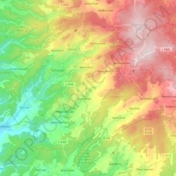
Name: Schotten topographic map, elevation, terrain.

Location: Schotten, Vogelsbergkreis, Hesse, 63679, Germany (50.42423 9.04027 50.54947 9.27064)

Average elevation: 1,411 ft

Minimum elevation: 512 ft

Maximum elevation: 2,533 ft

Other topographic maps

Click on a map to view its topography, its elevation and its terrain.

Lauterbach

Germany > Hesse > Vogelsbergkreis

Average elevation: 1,184 ft

Gear up for your next adventure:

📦Gear Storage Bags - Organize and protect outdoor equipment
Solar GPS Watches - Advanced multisport watches with built-in topographic maps
🗃️Trail First Aid Kit - Essential kit for outdoor injuries and emergencies
🔋Rechargeable Batteries - Power up your outdoor devices
🧭Map Reading Tools - Tools and kits for map navigation

As an Amazon Associate, this site earns from qualifying purchases at no extra cost to you.