Geolocate

Brest topographic map

Click on the map to display elevation.

About this map
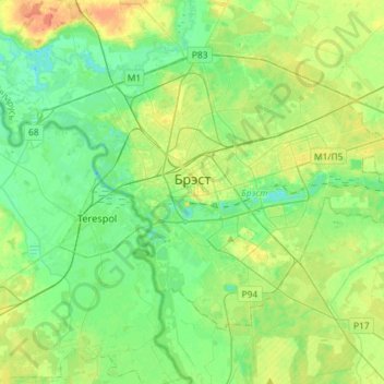
Name: Brest topographic map, elevation, terrain.

Location: Brest, Brest Region, Belarus (52.02378 23.56544 52.15104 23.85439)

Average elevation: 449 ft

Minimum elevation: 407 ft

Maximum elevation: 531 ft

Other topographic maps

Click on a map to view its topography, its elevation and its terrain.
Gear up for your next adventure:

🔦Compact Flashlight - Reliable flashlight for emergencies
🗺️NatGeo Topo Maps - High-quality waterproof printed topographic maps of US Parks
💧Water Purification System - Clean water on the trail with reliable purifiers
🚗GPS Dash Cams - Record your scenic drives through mountain passes and canyons
📡GPS Antenna Upgrade - Enhance GPS reception in remote terrain

As an Amazon Associate, this site earns from qualifying purchases at no extra cost to you.