Geolocate

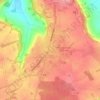
Curel topographic map

Click on the map to display elevation.

About this map

Name: Curel topographic map, elevation, terrain.

Location: Curel, Saint-Dizier, Haute-Marne, Grand Est, Metropolitan France, 52300, France (48.48385 5.12328 48.51381 5.16863)

Average elevation: 778 ft

Minimum elevation: 554 ft

Maximum elevation: 1,073 ft

Other topographic maps

Click on a map to view its topography, its elevation and its terrain.

Soôte

France > Grand Est > Haute-Marne > Longeau-Percey

Average elevation: 1,132 ft

Beaucharmoy

France > Grand Est > Haute-Marne > Le Châtelet-sur-Meuse

Average elevation: 1,243 ft

Montesson

France > Grand Est > Haute-Marne > Pierremont-sur-Amance

Average elevation: 928 ft

Ferme Febvre

France > Grand Est > Haute-Marne > Le Châtelet-sur-Meuse

Average elevation: 1,309 ft

Saint-Mars

France > Grand Est > Haute-Marne > Louvemont

Average elevation: 499 ft

Le Canar

France > Grand Est > Haute-Marne > Saints-Geosmes

Average elevation: 1,457 ft

Gear up for your next adventure:

🔥Plasma Lighters - Windproof lighters that work in any weather condition
🥇GPS Hiking Watch - Multi‑sport GPS watch with navigation and trail tracking
🥄Camping Utensil Set - Lightweight utensils for outdoor meals
🥾Hiking Shoes - Durable and comfortable shoes for trail hiking
📷Action Camera - Capture your outdoor adventures in HD

As an Amazon Associate, this site earns from qualifying purchases at no extra cost to you.