

San Francisco del Rincón topographic map
Click on the map to display elevation.
San Francisco del Rincón
The settlement was founded as San Francisco del Tule on January 21, 1607 by a group of families of the Purépecha and Hñähñu (Otomi) ethnicities. It was declared a villa (town) on September 6, 1865 and a city on March 27, 1867. It is located at 21°01′22″N 101°51′36″W / 21.02278°N 101.86000°W / 21.02278; -101.86000, at an approximate altitude of 1,721 meters.
About this map
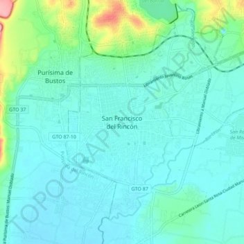
Name: San Francisco del Rincón topographic map, elevation, terrain.
Location: San Francisco del Rincón, Guanajuato, 36300, Mexico (20.97667 -101.89462 21.05667 -101.81462)
Average elevation: 5,797 ft
Minimum elevation: 5,725 ft
Maximum elevation: 6,148 ft