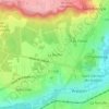
Arpajon topographic map
Click on the map to display elevation.
Arpajon
The commune consists of only 240 hectares but it is the capital of Arpajonnais Country which extends from Breuillet in the east to Brétigny-sur-Orge in the west and from Leuville-sur-Orge in the north to Cheptainville in the south. The relatively small size of the commune does not preclude a significant height differential from 89 to 47 metres altitude which causes a relatively large concentration of buildings on nearly 80% of the territory. Agricultural areas, which represent only 10% of the territory, are located in the extreme north-east of the commune along Route nationale 20.
About this map

Name: Arpajon topographic map, elevation, terrain.
Average elevation: 249 ft
Minimum elevation: 144 ft
Maximum elevation: 318 ft
Other topographic maps
Click on a map to view its topography, its elevation and its terrain.
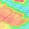
Paris Basin
France > Ile-de-France > Essonne > Bièvres
The landscape is one of very broad valleys (flood plains), modest watershed hills and well-drained plateaux of comparatively little altitude. In the south-east and east the plain of Champagne and the Seuil de Bourgogne (Threshold of Burgundy) differential erosion of the strata has left low scarps with the dip…
Average elevation: 413 ft
Paris Basin
France > Ile-de-France > Essonne > Bièvres
The landscape is one of very broad valleys (flood plains), modest watershed hills and well-drained plateaux of comparatively little altitude. In the south-east and east the plain of Champagne and the Seuil de Bourgogne (Threshold of Burgundy) differential erosion of the strata has left low scarps with the dip…
Average elevation: 413 ft