Geolocate

Naggio topographic map

Click on the map to display elevation.

About this map

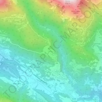
Name: Naggio topographic map, elevation, terrain.

Location: Naggio, Grandola ed Uniti, Como, Lombardy, 22010, Italy (46.02116 9.18181 46.06116 9.22181)

Average elevation: 2,136 ft

Minimum elevation: 902 ft

Maximum elevation: 5,354 ft

Gear up for your next adventure:

🌎3D Topographic Globes - Raised relief globes for a tactile understanding of geography
🌡️Portable Weather Meter - Track weather conditions on the trail
🪶Wildlife Field Guides - Learn animal tracking and species ID
🥄Camping Utensil Set - Lightweight utensils for outdoor meals
🧢Outdoor Hiking Hat - Sun protection hat for outdoor explorers

As an Amazon Associate, this site earns from qualifying purchases at no extra cost to you.