Geolocate

Blue topographic map

Click on the map to display elevation.

About this map

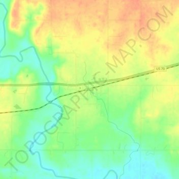
Name: Blue topographic map, elevation, terrain.

Location: Blue, Bryan County, Oklahoma, 74726, United States (33.97649 -96.24999 34.01649 -96.20999)

Average elevation: 581 ft

Minimum elevation: 509 ft

Maximum elevation: 643 ft

Bryan County trails, hiking, mountain biking, running and outdoor activities

Other topographic maps

Click on a map to view its topography, its elevation and its terrain.

Durant

United States > Oklahoma > Bryan County

Average elevation: 669 ft

Calera

United States > Oklahoma > Bryan County

Average elevation: 692 ft

Denison Dam

United States > Oklahoma > Bryan County > Cartwright

Average elevation: 594 ft

Fort Washita

United States > Oklahoma > Bryan County > Fort Washita

Average elevation: 673 ft

Durant

United States > Oklahoma > Bryan County

Average elevation: 669 ft

Gear up for your next adventure:

📶Vehicle Signal Boosters - Improve reception in rural areas while driving to trailheads
🧭Map Reading Tools - Tools and kits for map navigation
🔭Compact Binoculars - HD vision for scouting terrain and identifying distant landmarks
🏕️Family Camping Gear - Essentials for group camping trips
🧤Tactile Hiking Gloves - Keep hands warm while operating GPS and smartphone screens

As an Amazon Associate, this site earns from qualifying purchases at no extra cost to you.