
Durant topographic map
Click on the map to display elevation.
About this map
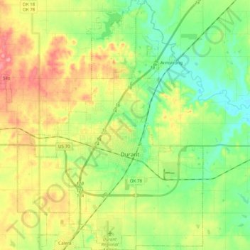
Name: Durant topographic map, elevation, terrain.
Location: Durant, Bryan County, Oklahoma, United States (33.92999 -96.46578 34.09185 -96.32048)
Average elevation: 669 ft
Minimum elevation: 538 ft
Maximum elevation: 873 ft
Bryan County trails, hiking, mountain biking, running and outdoor activities
Other topographic maps
Click on a map to view its topography, its elevation and its terrain.