Geolocate

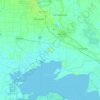
Marsh Island topographic map

Click on the map to display elevation.

About this map

Name: Marsh Island topographic map, elevation, terrain.

Location: Marsh Island, Iberia Parish, Louisiana, United States (29.47672 -92.03087 29.63722 -91.76504)

Average elevation: 3 ft

Minimum elevation: -10 ft

Maximum elevation: 20 ft

Other topographic maps

Click on a map to view its topography, its elevation and its terrain.
Masters

United States > Louisiana > Iberia Parish

Average elevation: 10 ft

Avery Island

United States > Louisiana > Iberia Parish

Average elevation: 10 ft

Weeks

United States > Louisiana > Iberia Parish

Average elevation: 13 ft

Brannon

United States > Louisiana > Iberia Parish > New Iberia

Average elevation: 20 ft

Gear up for your next adventure:

🔊Portable Camp Speaker - Music and alerts at camp
🦟Ultrasonic Repellers - Create a bug-free zone at your camp or rest stop
🧷Carabiner Set - Durable clips for gear attachment
🎒Hydration Pack - Hands‑free water reservoir for long hikes
🌧️Backpack Rain Cover - Keep gear dry in wet weather

As an Amazon Associate, this site earns from qualifying purchases at no extra cost to you.