
Hot Springs topographic map
Click on the map to display elevation.
About this map
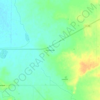
Name: Hot Springs topographic map, elevation, terrain.
Location: Hot Springs, Lassen County, California, United States (41.12628 -121.05858 41.16628 -121.01858)
Average elevation: 4,180 ft
Minimum elevation: 4,140 ft
Maximum elevation: 4,245 ft
Lassen County trails, hiking, mountain biking, running and outdoor activities
Other topographic maps
Click on a map to view its topography, its elevation and its terrain.
Susanville
United States > California > Lassen County
Susanville (formerly known as Rooptown) is a town in and is the county seat of Lassen County, California, United States. Susanville is located on the Susan River in the southern part of the county, at an elevation of 4,186 feet (1,276 m). Its population is 16,728 as of the 2020 census, down from 17,947 from…
Average elevation: 4,413 ft
Westwood
United States > California > Lassen County
Westwood is a census-designated place (CDP) in Lassen County, California, United States. Westwood is located 20 miles (32 km) west-southwest of Susanville, at an elevation of 5,128 feet (1,563 m). Its population is 1,541 as of the 2020 census, down from 1,647 from the 2010 census..
Average elevation: 5,174 ft