Geolocate

Kaying topographic map

Click on the map to display elevation.

About this map

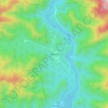
Name: Kaying topographic map, elevation, terrain.

Location: Kaying, Kaying EAC, Siang district, Arunachal Pradesh, India (28.37339 94.63881 28.45339 94.71881)

Average elevation: 2,352 ft

Minimum elevation: 984 ft

Maximum elevation: 6,184 ft

Gear up for your next adventure:

📡Handheld GPS Device - Reliable handheld GPS for outdoor navigation
🦺Reflective Outdoor Gear - Safety gear for low‑light conditions
🥾Hiking Shoes - Durable and comfortable shoes for trail hiking
📷Action Cameras - Rugged cameras to document your journeys across rugged terrain
🛌Ultralight Sleeping Bags - Compact down bags for cold nights in the wilderness

As an Amazon Associate, this site earns from qualifying purchases at no extra cost to you.