
Falls of the Neuse Dam topographic map
Interactive map
Click on the map to display elevation.
About this map
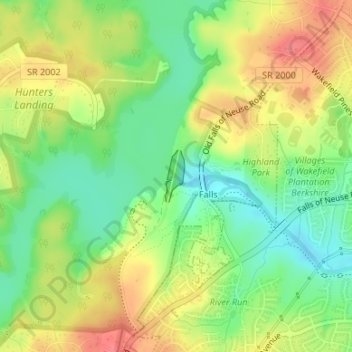
Name: Falls of the Neuse Dam topographic map, elevation, terrain.
Average elevation: 292 ft
Minimum elevation: 190 ft
Maximum elevation: 400 ft
Wake County trails, hiking, mountain biking, running and outdoor activities