
Thank you for supporting this site ❤️
Make a donation
Make a donation
Gear up for your next adventure:
As an Amazon Associate, this site earns from qualifying purchases at no extra cost to you.
Moselos topographic map
Click on the map to display elevation.
Thank you for supporting this site ❤️
Make a donation
Make a donation
Gear up for your next adventure:
As an Amazon Associate, this site earns from qualifying purchases at no extra cost to you.
About this map
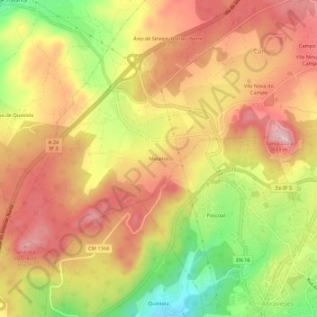
Name: Moselos topographic map, elevation, terrain.
Location: Moselos, Campo, Viseu, 3515-390, Portugal (40.67570 -7.96106 40.71570 -7.92106)
Average elevation: 1,732 ft
Minimum elevation: 1,299 ft
Maximum elevation: 2,031 ft
Thank you for supporting this site ❤️
Make a donation
Make a donation
Gear up for your next adventure:
As an Amazon Associate, this site earns from qualifying purchases at no extra cost to you.