Geolocate

Stevens Crossing topographic map

Click on the map to display elevation.

About this map

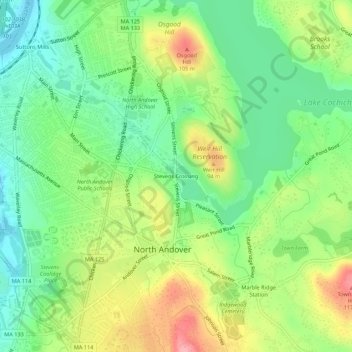
Name: Stevens Crossing topographic map, elevation, terrain.

Location: Stevens Crossing, North Andover, Essex County, Massachusetts, 01845, United States (42.67231 -71.13061 42.71231 -71.09061)

Average elevation: 167 ft

Minimum elevation: 20 ft

Maximum elevation: 390 ft

Essex County trails, hiking, mountain biking, running and outdoor activities

Other topographic maps

Click on a map to view its topography, its elevation and its terrain.

Gear up for your next adventure:

🧴Hand Sanitizer - Keep hands clean while hiking
📡Handheld GPS Device - Reliable handheld GPS for outdoor navigation
🗺️Topographic Maps - Detailed topo maps for hiking, exploring and outdoor navigation
GPS Sports Watch - GPS watch for running, hiking and training
🪓Survival Multi‑Tool - Versatile tool for camp and trail tasks

As an Amazon Associate, this site earns from qualifying purchases at no extra cost to you.