Geolocate

Prelerna topographic map

Click on the map to display elevation.

About this map

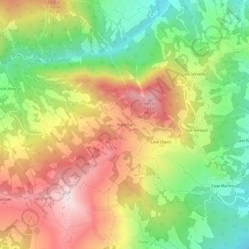
Name: Prelerna topographic map, elevation, terrain.

Location: Prelerna, Solignano, Parma, Emilia-Romagna, Italy (44.60474 9.92098 44.64474 9.96098)

Average elevation: 1,860 ft

Minimum elevation: 889 ft

Maximum elevation: 2,930 ft

Gear up for your next adventure:

🪶Survival Guide Book - Expert advice for emergency preparedness
🪶Camp Gear Gift Set - Perfect gift bundle for outdoor fans
🔊Portable Camp Speaker - Music and alerts at camp
👖Convertible Hiking Pants - Versatile zip-off pants for changing altitudes and temperatures
📦Gear Storage Bags - Organize and protect outdoor equipment

As an Amazon Associate, this site earns from qualifying purchases at no extra cost to you.