
Make a donation
Gear up for your next adventure:
As an Amazon Associate, this site earns from qualifying purchases at no extra cost to you.
Toquepala Caves topographic map
Click on the map to display elevation.
Make a donation
Gear up for your next adventure:
As an Amazon Associate, this site earns from qualifying purchases at no extra cost to you.
Toquepala Caves
Situated in the western Andes, they are in the Moquegua Region of the Osmore River. Located at an elevation of 2,200 m (7,200 ft) (2,800 m (9,200 ft) is also mentioned in another source[1]), they are two small caves each 15 m × 5 m (49 ft × 16 ft) in size, with a depth of 5 m (16 ft). The two Toquepala Caves in the high Sierra are located near the Quebrada Cimarron or along the Rio Locumba, which is a dry stream flowing from the Sierra to the desert.[2] The best known of the caves is "Abrigo del Diablo".[3]
Make a donation
Gear up for your next adventure:
As an Amazon Associate, this site earns from qualifying purchases at no extra cost to you.
About this map
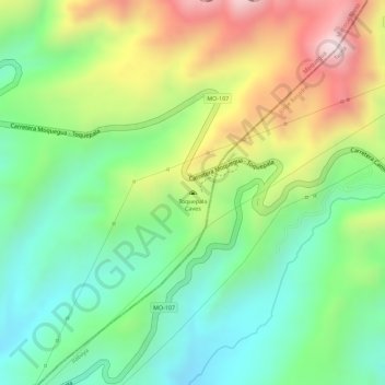
Name: Toquepala Caves topographic map, elevation, terrain.
Average elevation: 7,408 ft
Minimum elevation: 6,762 ft
Maximum elevation: 8,337 ft
Make a donation
Gear up for your next adventure:
As an Amazon Associate, this site earns from qualifying purchases at no extra cost to you.