Geolocate

Miramar topographic map

Click on the map to display elevation.

About this map

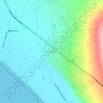
Name: Miramar topographic map, elevation, terrain.

Location: Miramar, Salaverry, Trujillo, La Libertad, 13600, Perú (-8.19947 -79.01375 -8.15947 -78.97375)

Average elevation: 138 ft

Minimum elevation: 0 ft

Maximum elevation: 600 ft

Gear up for your next adventure:

🪶Trail Camera - Capture wildlife on your hikes
🎁Geography Themed Gifts - Unique gift ideas for map lovers and geography enthusiasts
🧥Waterproof Jacket for Hiking - Breathable and rugged rain jacket for outdoor excursions
🌧️Backpack Rain Cover - Keep gear dry in wet weather
🌄Hiking Binoculars - Compact binoculars for scenic views and trail spotting

As an Amazon Associate, this site earns from qualifying purchases at no extra cost to you.