
Make a donation
Gear up for your next adventure:
As an Amazon Associate, this site earns from qualifying purchases at no extra cost to you.
Graditz topographic map
Click on the map to display elevation.
Make a donation
Gear up for your next adventure:
As an Amazon Associate, this site earns from qualifying purchases at no extra cost to you.
Graditz
Zwischen Graditz und Pülswerda steht in den Elbauen eine Stieleiche mit einem Brusthöhenumfang von 7,85 m und einer Höhe von 21 m.
Make a donation
Gear up for your next adventure:
As an Amazon Associate, this site earns from qualifying purchases at no extra cost to you.
About this map
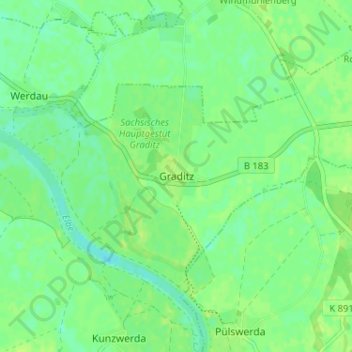
Name: Graditz topographic map, elevation, terrain.
Location: Graditz, Torgau, Nordsachsen, Sachsen, 04886, Deutschland (51.52415 13.04074 51.56415 13.08074)
Average elevation: 276 ft
Minimum elevation: 253 ft
Maximum elevation: 292 ft
Make a donation
Gear up for your next adventure:
As an Amazon Associate, this site earns from qualifying purchases at no extra cost to you.
Other topographic maps
Click on a map to view its topography, its elevation and its terrain.