
Make a donation
Gear up for your next adventure:
As an Amazon Associate, this site earns from qualifying purchases at no extra cost to you.
Börnicke topographic map
Click on the map to display elevation.
Make a donation
Gear up for your next adventure:
As an Amazon Associate, this site earns from qualifying purchases at no extra cost to you.
Börnicke
Birkenhöhe | Birkholz | Birkholzaue | Börnicke | Ladeburg | Lobetal | Schönow | Waldfrieden
Make a donation
Gear up for your next adventure:
As an Amazon Associate, this site earns from qualifying purchases at no extra cost to you.
About this map
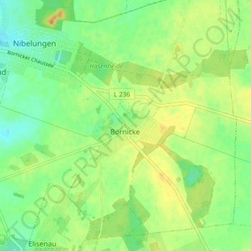
Name: Börnicke topographic map, elevation, terrain.
Location: Börnicke, Bernau, Barnim, Brandenburg, 16321, Deutschland (52.64362 13.61848 52.68362 13.65848)
Average elevation: 279 ft
Minimum elevation: 233 ft
Maximum elevation: 328 ft
Make a donation
Gear up for your next adventure:
As an Amazon Associate, this site earns from qualifying purchases at no extra cost to you.
Other topographic maps
Click on a map to view its topography, its elevation and its terrain.