Geolocate

Dumri topographic map

Click on the map to display elevation.

About this map

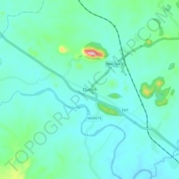
Name: Dumri topographic map, elevation, terrain.

Location: Dumri, Giridih, Jharkhand, 825106, India (23.95432 85.97187 24.03432 86.05187)

Average elevation: 961 ft

Minimum elevation: 817 ft

Maximum elevation: 1,768 ft

Gear up for your next adventure:

🛌Ultralight Sleeping Bags - Compact down bags for cold nights in the wilderness
📚USA Hiking Guide Books - Top trail guides and map books
🦶Hiking Gaiters - Keep debris and water out of your boots
📷Action Camera - Capture your outdoor adventures in HD
🛠️Outdoor Gear Repair Kit - Essential tools to fix gear on the trail

As an Amazon Associate, this site earns from qualifying purchases at no extra cost to you.