Geolocate

5th district topographic map

Click on the map to display elevation.

About this map

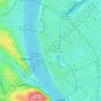
Name: 5th district topographic map, elevation, terrain.

Location: 5th district, Budapest, Central Hungary, Hungary (47.48579 19.04202 47.51475 19.06176)

Average elevation: 400 ft

Minimum elevation: 318 ft

Maximum elevation: 738 ft

Other topographic maps

Click on a map to view its topography, its elevation and its terrain.

Háros-sziget

Hungary > Budapest

Average elevation: 522 ft

Danube

Hungary > Budapest

Average elevation: 410 ft

Gear up for your next adventure:

🧥Waterproof Jacket for Hiking - Breathable and rugged rain jacket for outdoor excursions
🦟Ultrasonic Repellers - Create a bug-free zone at your camp or rest stop
🎒Gear Packing Cubes - Organize your backpack efficiently
🔦Compact Flashlight - Reliable flashlight for emergencies
🧢Outdoor Hiking Hat - Sun protection hat for outdoor explorers

As an Amazon Associate, this site earns from qualifying purchases at no extra cost to you.