
左左乡 topographic map
Interactive map
Click on the map to display elevation.
About this map
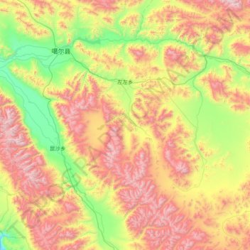
Name: 左左乡 topographic map, elevation, terrain.
Location: 左左乡, 噶尔县, 阿里地区, 西藏自治区, 中国 (31.69659 80.11969 32.63171 81.41882)
Average elevation: 16,316 ft
Minimum elevation: 13,527 ft
Maximum elevation: 21,024 ft
Other topographic maps
Click on a map to view its topography, its elevation and its terrain.