
Rockford Township topographic map
Interactive map
Click on the map to display elevation.
About this map
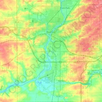
Name: Rockford Township topographic map, elevation, terrain.
Location: Rockford Township, Winnebago County, Illinois, United States (42.15013 -89.17393 42.32665 -88.94033)
Average elevation: 787 ft
Minimum elevation: 679 ft
Maximum elevation: 919 ft
Winnebago County trails, hiking, mountain biking, running and outdoor activities
Other topographic maps
Click on a map to view its topography, its elevation and its terrain.
Rock Cut State Park
United States > Illinois > Winnebago County > Machesney Park > Loves Park
Average elevation: 869 ft
Samuelson Corners
United States > Illinois > Winnebago County > Rockford > Samuelson Corners
Average elevation: 830 ft