Geolocate

Pucara topographic map

Click on the map to display elevation.

About this map

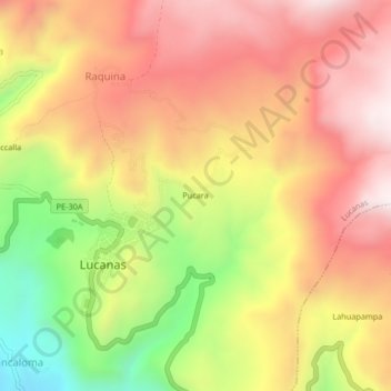
Name: Pucara topographic map, elevation, terrain.

Location: Pucara, Raquina, Lucanas, Ayacucho, Perú (-14.63522 -74.24364 -14.59522 -74.20364)

Average elevation: 11,417 ft

Minimum elevation: 9,859 ft

Maximum elevation: 12,549 ft

Gear up for your next adventure:

💧Water Filtration Bottles - Safely drink from streams and lakes while exploring
🛡️Insect Repellent - Protection against bugs during outdoor activities
🌧️Backpack Rain Cover - Keep gear dry in wet weather
🧭Compass with Lanyard - Easy‑carry compass for navigation
GPS Sports Watch - GPS watch for running, hiking and training

As an Amazon Associate, this site earns from qualifying purchases at no extra cost to you.