Geolocate

Mari topographic map

Click on the map to display elevation.

About this map

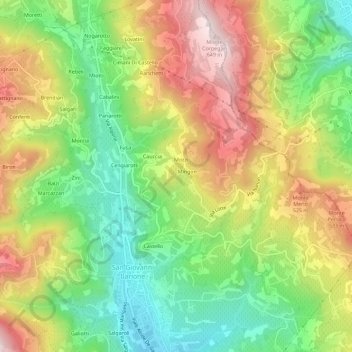
Name: Mari topographic map, elevation, terrain.

Location: Mari, San Giovanni Ilarione, Verona, Veneto, 37035, Italy (45.51491 11.22192 45.55491 11.26192)

Average elevation: 1,227 ft

Minimum elevation: 515 ft

Maximum elevation: 2,093 ft

Gear up for your next adventure:

🌄Hiking Binoculars - Compact binoculars for scenic views and trail spotting
🥾Hiking Shoes - Durable and comfortable shoes for trail hiking
🕶️GPS Smartphone Mount - Secure mount for phone navigation
🥤Water Filter Bottle - All‑in‑one filter bottle for safe hydration
🔭Compact Binoculars - HD vision for scouting terrain and identifying distant landmarks

As an Amazon Associate, this site earns from qualifying purchases at no extra cost to you.