Geolocate

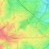
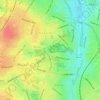
Vauxhall topographic map

Click on the map to display elevation.

About this map

Name: Vauxhall topographic map, elevation, terrain.

Location: Vauxhall, Birmingham, West Midlands Combined Authority, England, B7 4HW, United Kingdom (52.46547 -1.89595 52.50547 -1.85595)

Average elevation: 381 ft

Minimum elevation: 289 ft

Maximum elevation: 518 ft

Other topographic maps

Click on a map to view its topography, its elevation and its terrain.
Sutton Coldfield

United Kingdom > England > Birmingham

Average elevation: 407 ft

Edgbaston Reservoir

United Kingdom > England > Birmingham

Average elevation: 509 ft

Sutton Park

United Kingdom > England > Birmingham > Four Oaks

Average elevation: 476 ft

Lifford Reservoir

United Kingdom > England > Birmingham > Lifford

Average elevation: 492 ft

Perrott's Folly

United Kingdom > England > Birmingham > Chad Valley

Average elevation: 502 ft

Highbury Park

United Kingdom > England > Birmingham > Kings Heath

Average elevation: 466 ft

Pype Hayes

United Kingdom > England > Birmingham > Tyburn

Average elevation: 341 ft

Duddeston Viaduct

United Kingdom > England > Birmingham > Highgate

Average elevation: 384 ft

Frankley Reservoir

United Kingdom > England > Birmingham > Frankley

Average elevation: 643 ft

North Edgbaston

United Kingdom > England > Birmingham

Average elevation: 531 ft

Fox Covert

United Kingdom > England > Birmingham > Sutton Coldfield

Average elevation: 354 ft

Joy's Wood

United Kingdom > England > Birmingham > Wake Green

Average elevation: 459 ft

Calthorpe Park

United Kingdom > England > Birmingham > Highgate

Average elevation: 420 ft

Sutton Coldfield

United Kingdom > England > Birmingham

Average elevation: 407 ft

Sutton Park

United Kingdom > England > Birmingham > Four Oaks

Average elevation: 476 ft

Gear up for your next adventure:

🪶Camping Sleeping Pad - Comfortable sleeping pad for backpacking
🪑Portable Camp Table - Compact table for campsite meals
🍳Camping Cook Set - Complete cookware for outdoor meals
🧣Hiking Neck Gaiter - Multi‑use neck protection for outdoor weather
🏔️Mountain Trail Maps - High‑detail maps for popular peaks

As an Amazon Associate, this site earns from qualifying purchases at no extra cost to you.