
Thank you for supporting this site ❤️
Make a donation
Make a donation
Gear up for your next adventure:
As an Amazon Associate, this site earns from qualifying purchases at no extra cost to you.
Matiyal topographic map
Click on the map to display elevation.
Thank you for supporting this site ❤️
Make a donation
Make a donation
Gear up for your next adventure:
As an Amazon Associate, this site earns from qualifying purchases at no extra cost to you.
About this map
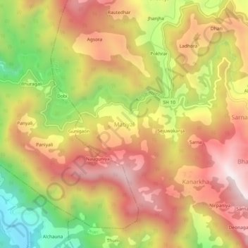
Name: Matiyal topographic map, elevation, terrain.
Location: Matiyal, Dhari, Nainital, Uttarakhand, India (29.35681 79.59104 29.39681 79.63104)
Average elevation: 5,663 ft
Minimum elevation: 3,944 ft
Maximum elevation: 6,982 ft
Thank you for supporting this site ❤️
Make a donation
Make a donation
Gear up for your next adventure:
As an Amazon Associate, this site earns from qualifying purchases at no extra cost to you.