
Thank you for supporting this site ❤️
Make a donation
Make a donation
Gear up for your next adventure:
As an Amazon Associate, this site earns from qualifying purchases at no extra cost to you.
Yatawara topographic map
Click on the map to display elevation.
Thank you for supporting this site ❤️
Make a donation
Make a donation
Gear up for your next adventure:
As an Amazon Associate, this site earns from qualifying purchases at no extra cost to you.
About this map
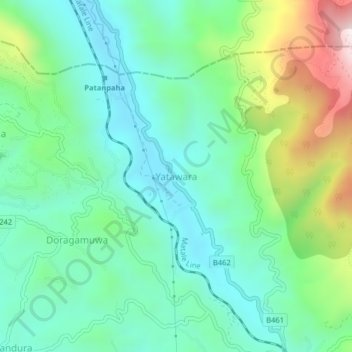
Name: Yatawara topographic map, elevation, terrain.
Location: Yatawara, Kandy District, Central Province, 20810, Sri Lanka (7.35286 80.64989 7.39286 80.68989)
Average elevation: 1,952 ft
Minimum elevation: 1,240 ft
Maximum elevation: 3,793 ft
Thank you for supporting this site ❤️
Make a donation
Make a donation
Gear up for your next adventure:
As an Amazon Associate, this site earns from qualifying purchases at no extra cost to you.