
Thank you for supporting this site ❤️
Make a donation
Make a donation
Gear up for your next adventure:
As an Amazon Associate, this site earns from qualifying purchases at no extra cost to you.
Manzanera topographic map
Click on the map to display elevation.
Thank you for supporting this site ❤️
Make a donation
Make a donation
Gear up for your next adventure:
As an Amazon Associate, this site earns from qualifying purchases at no extra cost to you.
About this map
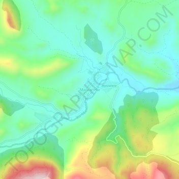
Name: Manzanera topographic map, elevation, terrain.
Location: Manzanera, Gúdar-Javalambre, Teruel, Aragón, España (40.03778 -0.85026 40.07778 -0.81026)
Average elevation: 3,517 ft
Minimum elevation: 3,110 ft
Maximum elevation: 4,465 ft
Thank you for supporting this site ❤️
Make a donation
Make a donation
Gear up for your next adventure:
As an Amazon Associate, this site earns from qualifying purchases at no extra cost to you.