Geolocate

Weesp topographic map

Click on the map to display elevation.

About this map

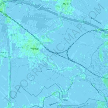
Name: Weesp topographic map, elevation, terrain.

Location: Weesp, North Holland, Netherlands (52.27798 5.01727 52.33087 5.10769)

Average elevation: -3 ft

Minimum elevation: -20 ft

Maximum elevation: 16 ft

Gear up for your next adventure:

📡GPS Antenna Upgrade - Enhance GPS reception in remote terrain
📦Gear Storage Bags - Organize and protect outdoor equipment
🎒Trail Energy Bars - High‑calorie bars for hiking energy
📖Nature Tracking Books - Learn to track wildlife and terrain
🔋Solar Power Banks - Keep your GPS and phone charged in remote wilderness areas

As an Amazon Associate, this site earns from qualifying purchases at no extra cost to you.