Geolocate

Windward Islands topographic map

Click on the map to display elevation.

About this map

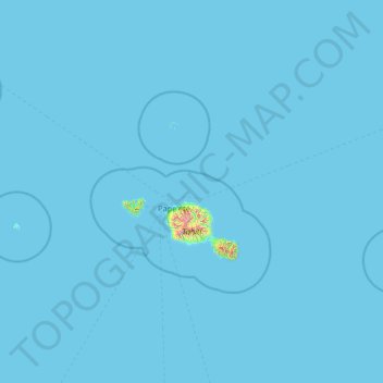
Name: Windward Islands topographic map, elevation, terrain.

Location: Windward Islands, French Polynesia, France (-17.88342 -150.65234 -16.98406 -148.05971)

Average elevation: 23 ft

Minimum elevation: 0 ft

Maximum elevation: 6,375 ft

Other topographic maps

Click on a map to view its topography, its elevation and its terrain.

Tiputa

France > French Polynesia > Tuamotu-Gambier > Rangiroa

Average elevation: 0 ft

Motu Tane

France > French Polynesia

Average elevation: 3 ft

Tatakoto

France > French Polynesia > Tatakoto

Average elevation: 0 ft

Maraa

France > French Polynesia > Windward Islands > Punaʻauiʻa

Average elevation: 2,224 ft

Coral reefs (high)

France > French Polynesia

Average elevation: 20 ft

Motu Teiku

France > French Polynesia > Gambier

Average elevation: 0 ft

Vaitape

France > French Polynesia > Bora-Bora > Vaitape

Average elevation: 72 ft

Faa'a

France > French Polynesia > Faaa

Average elevation: 269 ft

Gear up for your next adventure:

Solar GPS Watches - Advanced multisport watches with built-in topographic maps
Backpacking Tents - Weight-optimized shelters for multi-day topographic surveys
💧Water Filtration Bottles - Safely drink from streams and lakes while exploring
🥄Camping Utensil Set - Lightweight utensils for outdoor meals
🚪Portable Camp Chair - Foldable chair for comfort at camp

As an Amazon Associate, this site earns from qualifying purchases at no extra cost to you.