
Niugan topographic map
Click on the map to display elevation.
About this map
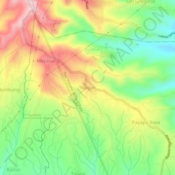
Name: Niugan topographic map, elevation, terrain.
Location: Niugan, Lemery, Batangas, Calabarzon, 4209, Philippines (13.98972 120.85324 14.02972 120.89324)
Average elevation: 1,132 ft
Minimum elevation: 699 ft
Maximum elevation: 1,644 ft
Other topographic maps
Click on a map to view its topography, its elevation and its terrain.