
Thank you for supporting this site ❤️
Make a donation
Make a donation
Gear up for your next adventure:
As an Amazon Associate, this site earns from qualifying purchases at no extra cost to you.
Lameira topographic map
Click on the map to display elevation.
Thank you for supporting this site ❤️
Make a donation
Make a donation
Gear up for your next adventure:
As an Amazon Associate, this site earns from qualifying purchases at no extra cost to you.
About this map
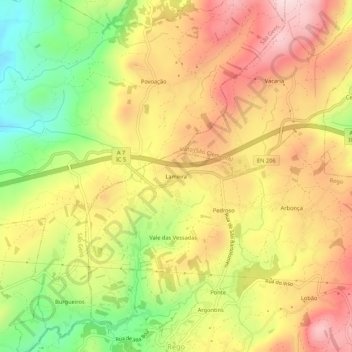
Name: Lameira topographic map, elevation, terrain.
Location: Lameira, Rego, Celorico de Basto, Braga, 4820-840, Portugal (41.42242 -8.10653 41.46242 -8.06653)
Average elevation: 2,185 ft
Minimum elevation: 1,519 ft
Maximum elevation: 2,756 ft
Thank you for supporting this site ❤️
Make a donation
Make a donation
Gear up for your next adventure:
As an Amazon Associate, this site earns from qualifying purchases at no extra cost to you.