
Rock topographic map
Click on the map to display elevation.
About this map
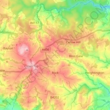
Name: Rock topographic map, elevation, terrain.
Location: Rock, Wyre Forest, Worcestershire, England, United Kingdom (52.31484 -2.43651 52.38823 -2.31094)
Average elevation: 436 ft
Minimum elevation: 102 ft
Maximum elevation: 761 ft
Other topographic maps
Click on a map to view its topography, its elevation and its terrain.
Stourport Historic Canal Basins
United Kingdom > England > Worcestershire > Wyre Forest > Stourport-on-Severn > Wilden
Average elevation: 108 ft
River Severn
United Kingdom > England > Worcestershire > Wyre Forest > Stourport-on-Severn
Average elevation: 148 ft
Shatterford
United Kingdom > England > Worcestershire > Wyre Forest > Upper Arley
Average elevation: 407 ft
Low Habberley
United Kingdom > England > Worcestershire > Wyre Forest > Ferndale
Average elevation: 279 ft