Geolocate

Bayambang topographic map

Click on the map to display elevation.

About this map

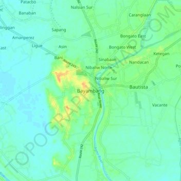
Name: Bayambang topographic map, elevation, terrain.

Location: Bayambang, Pangasinan, Ilocos Region, 2423, Philippines (15.76880 120.41407 15.84880 120.49407)

Average elevation: 56 ft

Minimum elevation: 30 ft

Maximum elevation: 128 ft

Gear up for your next adventure:

🏫Relief Map Kits - Hands-on tools for teaching landforms and elevation
🪵Folding Camp Saw - Compact saw for wood and campsite work
🧭Pro Hiking Compasses - High-accuracy liquid-filled compasses for topographic orientation
🛡️Insect Repellent - Protection against bugs during outdoor activities
🎒Waterproof Dry Bags - Keep your electronics and maps dry inside your pack

As an Amazon Associate, this site earns from qualifying purchases at no extra cost to you.