
Thank you for supporting this site ❤️
Make a donation
Make a donation
Gear up for your next adventure:
As an Amazon Associate, this site earns from qualifying purchases at no extra cost to you.
Cabril topographic map
Click on the map to display elevation.
Thank you for supporting this site ❤️
Make a donation
Make a donation
Gear up for your next adventure:
As an Amazon Associate, this site earns from qualifying purchases at no extra cost to you.
About this map
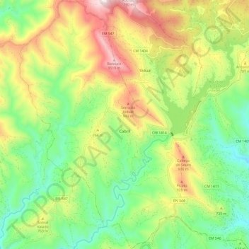
Name: Cabril topographic map, elevation, terrain.
Location: Cabril, Pampilhosa da Serra, Coimbra, Portugal (40.04737 -7.93142 40.13870 -7.85278)
Average elevation: 2,201 ft
Minimum elevation: 1,148 ft
Maximum elevation: 3,789 ft
Thank you for supporting this site ❤️
Make a donation
Make a donation
Gear up for your next adventure:
As an Amazon Associate, this site earns from qualifying purchases at no extra cost to you.