Geolocate

Bonbon topographic map

Click on the map to display elevation.

About this map

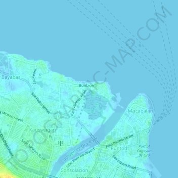
Name: Bonbon topographic map, elevation, terrain.

Location: Bonbon, Cagayan de Oro, Northern Mindanao, 9000, Philippines (8.48835 124.62965 8.52835 124.66965)

Average elevation: 7 ft

Minimum elevation: -3 ft

Maximum elevation: 75 ft

Gear up for your next adventure:

🎒Day Hiking Backpack - Lightweight backpack perfect for day trips and outdoor adventures
🪶Trail Camera - Capture wildlife on your hikes
🔭Stargazing Telescopes - Perfect for camping in low-light pollution areas shown on maps
📦Dry Bags Set - Waterproof storage for electronics and clothes
🧭Outdoor Navigation Book - Learn advanced navigation skills

As an Amazon Associate, this site earns from qualifying purchases at no extra cost to you.