Geolocate

Tinajani topographic map

Click on the map to display elevation.

About this map

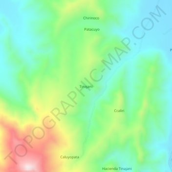
Name: Tinajani topographic map, elevation, terrain.

Location: Tinajani, Ayaviri, Province of Melgar, Puno, Peru (-14.99959 -70.61426 -14.95959 -70.57426)

Average elevation: 13,419 ft

Minimum elevation: 12,877 ft

Maximum elevation: 14,600 ft

Gear up for your next adventure:

🏕️Tent Footprint - Protect your tent base from wear
📚Navigation Handbooks - Master the art of reading topographic maps and using a compass
📶Satellite Messenger - Communication device off‑grid
🚗GPS Dash Cams - Record your scenic drives through mountain passes and canyons
🔦Compact Flashlight - Reliable flashlight for emergencies

As an Amazon Associate, this site earns from qualifying purchases at no extra cost to you.